Property Record
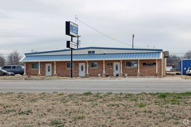
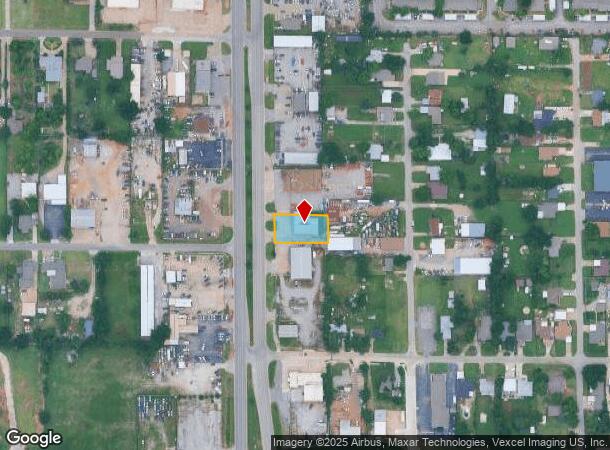
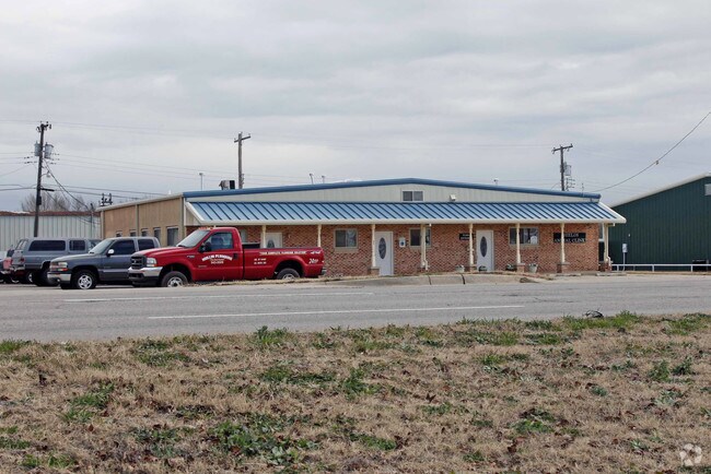
2920 N Shields Blvd, Moore, OK 73160
NEARBY LISTINGS FOR SALE OR LEASE
Property Detail
2920 N Shields Blvd
Oklahoma City, OK
Lockhoma Estates
R0012358
LOCKHOMA LOT 9 AND N16.5 N/2 LOT 10 BLK 1
Officebuilding
Cleveland
X
Oklahoma
40027C0157K
9
2024
0.34 AC
2024
Moore
202002
Oklahoma City
4,779 SF
DEMOGRAPHICS near 2920 N Shields Blvd
1 Mile
3 Mile
5 Mile
2024 Total Population
9,083
85,100
224,568
2029 Population
9,445
87,851
231,375
Pop Growth 2024-2029
+ 3.99%
+ 3.23%
+ 3.03%
Average Age
38
38
37
2024 Total Households
3,782
33,457
83,639
HH Growth 2024-2029
+ 4.07%
+ 3.40%
+ 3.19%
Median Household Inc
$54,133
$57,497
$57,126
Avg Household Size
2.30
2.50
2.60
2024 Avg HH Vehicles
2.00
2.00
2.00
Median Home Value
$156,499
$155,242
$152,199
Median Year Built
1982
1979
1979
Nearby Places
Map Layers
Map Styles
 Street
 Aerial
- Restaurants
- Banks
- Shops
- Fitness
- Groceries
PUBLIC TRANSPORTATION
COMMUTER RAIL
Oklahoma City (Heartland Flyer - Amtrak)
DRIVE
WALK
Distance
Oklahoma City (Heartland Flyer - Amtrak)
11 min
6.8 mi
AIRPORT
Will Rogers World
DRIVE
WALK
Distance
Will Rogers World
18 min
9.2 mi
Freight Ports
Tulsa Port Of Catoosa
DRIVE
WALK
Distance
Tulsa Port Of Catoosa
142 min
129.8 mi
Nearby Properties
Address
Land Use
TOTAL SIZE
Lot Size
Zoning
Address
Land Use
TOTAL SIZE
Lot Size
Zoning
210,816 SF
10.45 AC
Address
Land Use
TOTAL SIZE
Lot Size
Zoning
1,600 SF
25 AC
Address
Land Use
TOTAL SIZE
Lot Size
Zoning
50.08 AC
Address
Land Use
TOTAL SIZE
Lot Size
Zoning
125,954 SF
11.92 AC
R4
Address
Land Use
TOTAL SIZE
Lot Size
Zoning
29.38 AC
Address
Land Use
TOTAL SIZE
Lot Size
Zoning
Address
Land Use
TOTAL SIZE
Lot Size
Zoning
0.16 AC
C6
Address
Land Use
TOTAL SIZE
Lot Size
Zoning
2,123 SF
53.41 AC
C3
Address
Land Use
TOTAL SIZE
Lot Size
Zoning
40.15 AC
AA
Address
Land Use
TOTAL SIZE
Lot Size
Zoning
155.94 AC
Address
Land Use
TOTAL SIZE
Lot Size
Zoning
11.36 AC
C4
Address
Land Use
TOTAL SIZE
Lot Size
Zoning
Address
Land Use
TOTAL SIZE
Lot Size
Zoning
5.14 AC
Address
Land Use
TOTAL SIZE
Lot Size
Zoning
57,536 SF
66.21 AC
R4
Address
Land Use
TOTAL SIZE
Lot Size
Zoning
15.61 AC
C1
Address
Land Use
TOTAL SIZE
Lot Size
Zoning
Address
Land Use
TOTAL SIZE
Lot Size
Zoning
10 AC
R2
Address
Land Use
TOTAL SIZE
Lot Size
Zoning
Address
Land Use
TOTAL SIZE
Lot Size
Zoning
Address
Land Use
TOTAL SIZE
Lot Size
Zoning
347,050 SF
18.56 AC
Address
Land Use
TOTAL SIZE
Lot Size
Zoning
40.90 AC
Address
Land Use
TOTAL SIZE
Lot Size
Zoning
0.77 AC
Address
Land Use
TOTAL SIZE
Lot Size
Zoning
14,714 SF
14.41 AC
Address
Land Use
TOTAL SIZE
Lot Size
Zoning
70.01 AC
Address
Land Use
TOTAL SIZE
Lot Size
Zoning
0.64 AC
Address
Land Use
TOTAL SIZE
Lot Size
Zoning
10.81 AC
Address
Land Use
TOTAL SIZE
Lot Size
Zoning
1.40 AC
Address
Land Use
TOTAL SIZE
Lot Size
Zoning
104.87 AC
Address
Land Use
TOTAL SIZE
Lot Size
Zoning
232,037 SF
18.80 AC
C-3
Address
Land Use
TOTAL SIZE
Lot Size
Zoning
403,745 SF
26.03 AC
I-3
The World's #1 Commercial Real Estate Marketplace
Connect with us
© 2025 CoStar Group
The information above has been obtained from sources believed reliable. While we do not doubt its accuracy we have not verified it and make no guarantee, warranty or representation about it. It is your responsibility to independently confirm its accuracy and completeness. Any projections, opinions, assumptions, or estimates used are for example only and do not represent the current or future performance of the property. The value of this transaction to you depends on tax and other factors which should be evaluated by your tax, financial, and legal advisors. You and your advisors should conduct a careful, independent investigation of the property to determine to your satisfaction the suitability of the property for your needs.